


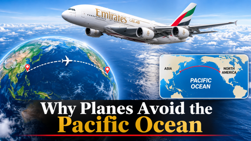
Pacific Ocean flights often take routes that appear unusually curved on maps, leaving many travellers wondering why aeroplanes do not simply fly directly across the world’s largest ocean.
Although commercial aircraft regularly cross the Pacific, their routes are carefully planned around geographical distances, weather conditions, fuel consumption, air traffic requirements and the availability of suitable emergency diversion airports.
The explanation is not that flying over the Pacific is impossible or inherently dangerous. Instead, airlines select routes that provide the best balance between travel time, operational efficiency and safety.
Pacific Ocean Flights and the Mystery of Curved Routes
One of the biggest reasons some Pacific flights appear to avoid a direct route is the way the Earth is represented on maps.
Most familiar world maps are flat, but the Earth is spherical. Consequently, the shortest distance between two locations on a globe does not necessarily appear as a straight line when displayed on a flat map.
Airlines use what is known as the great-circle route, which represents the shortest path between two points on a spherical surface.
For example, a flight travelling between North America and parts of Asia may follow a route that bends towards the Arctic rather than appearing to travel straight across the Pacific on a conventional map.
This does not mean the aircraft is taking an unnecessary detour. The route may actually cover less distance than the apparently straight alternative.
The distinction between a flat map and a globe is therefore important when interpreting flight-tracking maps.
Why Airlines Consider Emergency Landing Options
Another important consideration is the availability of airports along a flight route.
Unlike journeys across continents, long-distance flights over the Pacific can spend several hours travelling above water, far from major airports.
If an aircraft develops a technical problem, experiences an engine failure or encounters another situation requiring an unscheduled landing, pilots may need to divert to a suitable airport.
This is where Extended Operations, commonly known as ETOPS, becomes important.
ETOPS refers to regulatory requirements governing aircraft operations over routes where suitable diversion airports may be a considerable distance away.
Under United States Federal Aviation Administration regulations, operators must meet specific aircraft, maintenance, operational and diversion-planning requirements before conducting approved extended-range operations.
Importantly, the regulations also recognise extended operations over Pacific Ocean areas.
The FAA explains that ETOPS standards establish requirements covering maintenance, alternate airport selection, dispatch and flight operations to protect aircraft if a diversion becomes necessary.
This means airlines do not simply choose an oceanic route and hope for the best. They must establish that their aircraft and operational arrangements meet the applicable requirements.
How Aircraft Engine Technology Changed Pacific Flights
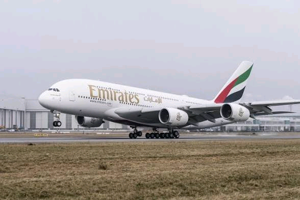
Aircraft technology has significantly changed how airlines operate long-distance international flights.
In earlier decades, airlines often relied on aircraft with three or four engines for particularly long journeys because having additional engines offered operational advantages.
However, modern twin-engine aircraft have become increasingly capable of conducting long-distance international journeys.
Aircraft such as the Boeing 777, Boeing 787 Dreamliner and Airbus A350 are examples of modern aircraft used on long-haul routes.
Their ability to operate extended oceanic journeys depends on aircraft certification, engine reliability, airline approval and compliance with applicable operational requirements.
The FAA’s regulations even provide for ETOPS operations lasting 240 minutes and beyond on approved routes, including specified Pacific Ocean areas.
Therefore, the idea that commercial aircraft cannot safely cross large sections of the Pacific because they have only two engines is outdated.
How Weather and Winds Influence Flight Routes
Weather is another major factor airlines consider when planning Pacific Ocean flights.
Aircraft do not always follow identical routes because atmospheric conditions change. Strong winds, turbulence, storms and other weather systems can influence the route selected for a particular journey.
One particularly important factor is the jet stream.
According to the United States National Oceanic and Atmospheric Administration (NOAA), jet streams are relatively narrow bands of strong winds found high in the atmosphere. They generally travel from west to east.
When aircraft travel in the same direction as favourable winds, they can receive a speed boost. Flying against strong headwinds, however, can increase journey times and fuel consumption.
Airlines therefore examine wind forecasts and other weather information when selecting flight paths.
The International Civil Aviation Organization’s 2026 presentation on the North Pacific route system explains that Pacific Organized Track System (PACOTS) routes are established daily.
These routes consider flight time, fuel consumption, prevailing winds, bad weather and restricted airspace.
This explains why two flights travelling between similar destinations may follow different paths depending on the day and prevailing conditions.
Pacific Flights Also Follow Organised Air Traffic Routes
The Pacific is not an uncontrolled region where aircraft independently choose any direction they want.
International aviation authorities coordinate traffic through established procedures and designated airspace arrangements.
One example is PACOTS, which provides organised routes for traffic travelling between destinations such as Japan, North America and Hawaii.
These tracks can change according to traffic demand, weather conditions and operational requirements.
The FAA also operates an advanced oceanic air traffic management system known as Advanced Technologies and Oceanic Procedures (ATOP).
According to the agency, the system supports air traffic control across approximately 23 million square miles of airspace delegated to the United States over the Atlantic, Pacific and Arctic oceans.
This demonstrates the scale of coordination required to manage international flights across remote oceanic regions.
So, Do Aeroplanes Actually Fly Across the Pacific?
Yes. Thousands of commercial operate across the Pacific region, connecting major destinations in Asia, North America, Oceania and other parts of the world.
The Pacific is an important international aviation corridor, particularly for flights connecting cities such as Tokyo, Los Angeles, Sydney, Honolulu and other major destinations.
Some journeys cross extensive stretches of open water, while others follow routes that pass closer to islands, coastlines or alternative airports.
The decision depends on the aircraft, destination, weather, available airspace, operational approvals and the airline’s flight-planning calculations.
Ultimately, the belief that aeroplanes rarely fly over the Pacific is largely a misunderstanding of how international flight routes appear on flat maps.
Aircraft do cross the world’s largest ocean. They simply do so using carefully calculated routes that account for distance, weather, fuel efficiency, air traffic management and emergency planning.